
Globally, the effects of climate change are already being observed through increases in drought, forest fires, sea level rise, flooding, and hunger. Given the vulnerability of Pacific Island countries and territories (PICTs) in this respect, the Pacific region specifically faces unique challenges in managing natural resources and biodiversity, securing economies and livelihoods, and ensuring sustainable food systems. Digital public infrastructure (DPI) that supports the flow and exchange of data and services is critical in overcoming these challenges.
While DPI often focuses on digital identity, money transfer or exchange of personal information, the availability and free flow of data across institutions, ministries, and borders often underpins those components, and can be a vital tool in building resilient digital societies.
For example, satellite data has been collected for decades, but traditionally has not been used to its full potential due to constraints around cost, bandwidth, and preparation time. When Landsat data from US satellites became free in 2008, it resulted in a 20x increase in the use of Landsat imagery. By 2017, it was estimated that the use of Landsat data was providing 3.45 billion USD in benefits to users. Similarly, when the US military made Global Positioning Systems (GPS) available to the public , it opened the floodgates to new innovations and possibilities, including modern mapping applications and smartphones.
What is Landsat data?
Landsat shows us Earth from space. Since the first Landsat satellite launched in 1972, the mission has collected data on the forests, farms, urban areas and freshwater of our home planet, generating the longest continuous record of its kind.
Advancements in technology such as smartphones, sensors, and monitoring equipment are allowing geospatial, Earth, and marine observation data to scale at an unprecedented rate. New satellites are entering orbit each month, providing a wealth of information that can help address many of the challenges across the Pacific. However, there continues to be a gap in providing access to these data in the right form and quality needed to effectively inform policy, decision-making, and action according to the needs and priorities of the region.
The Digital Earth Pacific project tackles the data issue head-on
The Digital Earth Pacific project represents fundamental digital infrastructure that will ensure every country in the Pacific has access to technology and services to routinely and reliantly monitor and respond to challenges such as sea level rise; illegal fishing, mining, and deforestation; and conservation of coastal and marine habitats. The project infrastructure condenses decades of freely available satellite data to provide near real-time understanding of the changing environment such as coastline change, freshwater quantity, marine ecosystem health, land use and land cover characteristics, and weather outlooks on agricultural production and disaster preparedness.
Digital Earth Pacific in their own words
The Digital Earth Pacific (DEP) program will support the development of an operational Earth observation system that takes decades of freely available data and brings it together in a sensible way within the Pacific context. It will allow Member States to make more informed decisions based on good information to overcome challenges such as climate change, food security and disasters.
This program has been initiated by the Pacific Community (SPC), which is the principal scientific and technical organization serving the Pacific Region since 1947. SPC will work with stakeholders across the region to establish DEP through demand-driven, user-centric design approaches that focus on user engagement to understand the needs, priorities, and capacity of the region. This will require an emphasis on communications, outreach and engagement, and creating strong, multi-stakeholder partnerships where finance, data, technology, and expertise can be leveraged and scaled to deliver the program’s outcomes. Digital Earth Pacific will be formally launched in October 2023 at SPC’s annual Committee of Representatives of Governments and Administrations (CRGA).
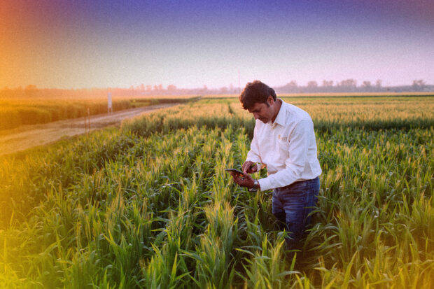
The program’s ultimate goal is to facilitate a digital platform in which people and communities can easily understand, and thus plan for, climate change’s effects on their environment. At this level of insight and delivery, DEP could be helpful in a variety of ways. For example, at full capacity, the program would function so that farmers understand if their crops are failing and how to mitigate; planners and community leaders understand where coastal erosion is most prominent and what this means for community infrastructure; and fishermen are able to map fishing ground and threats to marine habitats. In the Pacific, where nearly 50% of the population have mobile phone subscriptions– 80% of which use smartphones (GSMA)—the benefits to people and communities would be significant.
Elements of the governance and engagement model that make it built to last
Open and collaborative: DEP will be institutionalized within SPC, who works with its member countries on scientific and technical issues. Products and services generated by the DEP program will be free and open, as will the core data infrastructure – allowing any user to generate their own data products or value-added applications and services. DEP will work with stakeholders in the region to develop a co-design process such that local needs and knowledge can be incorporated into the design of each product, while also building trust and ownership.
Inclusive governance: Underscoring the engagement process will be a governance framework that leverages the annual CRGA meeting where leaders and high-level government officials gather to discuss priorities for the region. A Steering Committee made of country-level government officials from the Pacific as well as regional and international civil society and private sector institutions will also provide strategic guidance to the program and support alignment with existing programs and initiatives. This governance approach will ensure responsiveness to regional needs and priorities, provide engagement opportunities at both political and technical levels, and support broader outreach and uptake of DEP products and services. This governance mechanism will also allow the DEP program to identify and mitigate potential risks.
Capacity strengthening: Capacity for the analysis and use of satellite data across the region is fairly limited. Therefore, it will be important to fully understand this landscape and its implications for tools, resources, and methods to develop capacity, as well as the impact more broadly for the uptake of DEP data, products, and services. Capacity development and training workshops will take place with users from the technical level to the policy level to ensure technical capacity can be built, while interpretation of each data product and its relevance to decision-making, policy and action at the country-level can be well understood.
Data sovereignty and privacy: Concerns related to data sovereignty, security or privacy may arise from country representatives. It is important to note that the core satellite data that DEP will make available has already been collected, in some cases for decades, and is made openly available to the world. What’s unique here is that these analysis-ready format data will be analyzed into the aforementioned data products and services that any country or user can use. While some issues can arise from how these products are interpreted, the DEP program will develop a data governance framework and data validation model so that rules, procedures, and guidance are well understood, as is the overall certainty of these data.
Financial sustainability: Perhaps the biggest risk for the program is failing to achieve a sustainable financing model. In international development, projects often receive funding for 2-3 years, and once the money runs out, the project ends. Understandably, many countries are averse to this paradigm. To address these concerns, the business case for DEP outlines a three-phased approach through 2030, during which time an operational infrastructure is in place, products and services are made available, capacity development is built, and an ecosystem of users driving further innovation is created. All that to say that the value proposition and impact during this period must be established to secure continued funding, for which both the CRGA and Steering Committee will be leveraged.
Lessons for future-forward, climate-ready digital public infrastructure
The development of any digital innovation program such as DEP comes with risks. The opportunity, however, will potentially be transformative for the region, as some of the data products, like annual coastline change, are urgently needed. To have these products available for every island in the region is a potential game changer as these datasets at scale over multiple years have never existed before. Insights gained from these services will support sustainable development efforts across the region and give countries the capability to monitor change, build scenarios, and measure effectiveness of policy decisions.
The consultative and inclusive governance model being established for DEP will be a sounding board for what is and is not working and allow the program team to adapt as necessary. A long-term focus on the governance processes, technical architectures, and responsive policies and action should be at the heart of this project, and others like it.
As the Digital Impact Alliance embarks to understand the ways in which digital public infrastructure can best confront the climate crisis, we look forward to learning from collaborations such as DEP. As initiatives like DEP explore the ways in which data exchange can enable climate preparedness, we hope to see DPI collaborators sharing open datasets, with security and privacy provisions in place where needed, and building interoperable systems capable of receiving and computing on the data exchanged.
For more on this perspective, read this expert comment on the twin transition and this paper on the considerations for digital and climate.
Our research agenda: DPI for positive climate action
This piece is part of a wider body of work exploring the intersection of digital public infrastructure and climate action. To understand this intersectionality better, the Digital Impact Alliance is undertaking research that blends our expertise in inclusive and trusted digital transformation with the global priority of climate action. Our objective is to test assumptions, uncover ideas, capture, and share best practices from countries, bring opportunities to life, and ultimately, drive positive impact for people. To learn more, read the article Setting a Research Agenda: DPI for Positive Climate Action.